
Texas is the second largest U.S. state, behind Alaska, with an area of 268,820 square miles (696,200 km2). It is 10% larger than France and almost twice as large as Germany or Japan, though it ranks only 27th worldwide amongst country subdivisions by size. If it were a country, Texas would be the 40th largest behind Chile and Zambia.
Texas is in the south-central part of the United States of America. Three of its borders are defined by rivers. The Rio Grande river forms a natural border with the Mexican states of Chihuahua, Coahuila, Nuevo León, and Tamaulipas to the south. The Red River forms a natural border with Oklahoma and Arkansas to the north. The Sabine River forms a natural border with Louisiana to the east. The Texas Panhandle has an eastern border with Oklahoma at 100° W, a northern border with Oklahoma at 36°30' N and a western border with New Mexico at 103° W. El Paso lies on the state's western tip at 32° N and the Rio Grande.
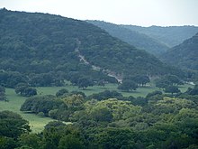
With 10 climatic regions, 14 soil regions, and 11 distinct ecological regions, regional classification becomes problematic with differences in soils, topography, geology, rainfall, and plant and animal communities. One classification system divides Texas, in order southeast to west, into the following: Gulf Coastal Plains, Interior Lowlands, Great Plains, and Basin and Range Province. The Gulf Coastal Plains region wraps around the Gulf of Mexico on the southeast section of the state. Vegetation in this region consists of thick pineywoods. The Interior Lowlands region consists of gently rolling to hilly forested land is part of a larger pine-hardwood forest. The Great Plains region in central Texas is located in spans through the state's panhandle and Llano Estacado to the state's hill country near Austin. This region is dominated by prairie and steppe. "Far West Texas" or the "Trans-Pecos" region is the state's Basin and Range Province. The most varied of the regions, this area includes Sand Hills, the Stockton Plateau, desert valleys, wooded mountain slopes and desert grasslands.

Texas has 3,700 named streams and 15 major rivers. The largest of these rivers is the Rio Grande. Other major rivers include the Pecos, the Brazos, Colorado, and Red River, which forms the border with Oklahoma. While Texas does not have any large natural lakes, Texans have built over 100 artificial reservoirs.
Texas's size and unique history makes its regional affiliation debatable: it can be fairly considered a Southern or a Southwestern state, or both. The vast geographic, economic, and cultural diversity within the state itself prohibits easy categorization of the whole state into a recognized region of the United States. The East, Central, and North Texas regions have a stronger association with the American South than with the Southwest. Others, such as far West Texas and South Texas share more similarities with the latter.
Geology

Texas is the southernmost part of the Great Plains, which ends in the south against the folded Sierra Madre Occidental of Mexico. The continental crust forms a stable Mesoproterozoic craton which changes across a broad continental margin and transitional crust into true oceanic crust of the Gulf of Mexico. The oldest rocks in Texas date from the Mesoproterozoic and are about 1,600 million years old. These Precambrian igneous and metamorphic rocks underlie most of the state, and are exposed in three places: Llano uplift, Van Horn, and the Franklin Mountains, near El Paso. Sedimentary rocks overlay most of these ancient rocks. The oldest sediments were deposited on the flanks of a rifted continental margin, or passive margin that developed during Cambrian time. This margin existed until Laurasia and Gondwana collided in the Pennsylvanian subperiod to form Pangea. This is the buried crest of the Appalachian Mountains–Ouachita Mountains zone of Pennsylvanian continental collision. This orogenic crest is today buried beneath the Dallas–Waco—Austin–San Antonio trend.
The late Paleozoic mountains collapsed as rifting in the Jurassic period began to open the Gulf of Mexico. Pangea began to break up in the Triassic, but seafloor spreading to form the Gulf of Mexico occurred only in the mid and late Jurassic. The shoreline shifted again to the eastern margin of the state and the Gulf of Mexico passive margin began to form.

Today 9 miles (14 km) to 12 miles (19 km) of sediments are buried beneath the Texas continental shelf and a large proportion of remaining US oil reserves are located here. At the start of its formation, the incipient Gulf of Mexico basin was restricted and seawater often evaporated completely to form thick evaporite deposits of Jurassic age. These salt deposits formed salt dome diapirs, and are found in East Texas along the Gulf coast.
East Texas outcrops consist of Cretaceous and Paleogene sediments which contain important deposits of Eocene lignite. The Mississippian and Pennsylvanian sediments in the north; Permian sediments in the west; and Cretaceous sediments in the east, along the Gulf coast and out on the Texas continental shelf contain oil. Oligocene volcanic rocks are found in far west Texas in the Big Bend area. A blanket of Miocene sediments known as the Ogallala formation in the western high plains region is an important aquifer. Located far from an active plate tectonic boundary, Texas has no volcanoes and few earthquakes.
No comments:
Post a Comment